The Lanark County Municipal Trails Corporation manages trails on county-owned property with a particular interest in offering accessible trail options. Many trails now feature boardwalks and graded paths, such as the trail at Purdon Conservation Area near Watsons Corners.
Although it’s less than a kilometre, the Baird trail is a circular route, and is one of the most beautiful trails around. Various points are marked with ecological values and one can find the most humungous individual maple and beech trees in the area. Old rail fences indicate farming practices of long ago and the forty year old red pine plantations under a Lanark County Forest Agreement provide a quiet sanctuary from the outside world. A sedge wetland in the middle of the property is halved by a fine boardwalk, affording a good view of typical wetland attributes.
Directions: To find this trail from Lanark Village, travel north on on Highway 511 to County Road 8 (Herron Mills Road) , turn right and travel east. There is a sign marking the park and trail and the property number is 1024.
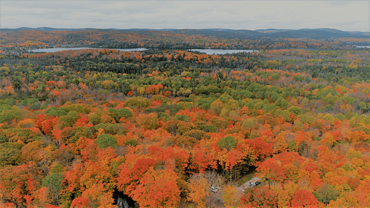
Hike to the top of Blueberry Mountain within the Clifford Family protected Wilderness (Lanark Highlands); the highest point in the County where the view astounds. This nature sanctuary is home to countless species of flora and fauna. Members of the Clifford family are stewards of the land, conserving and restoring the natural forests and wetlands and sharing them with the community.
Blueberry Mountain is located on Private Property. Hikers are welcome to take a self-guided walk to Blueberry Mountain. Permission to hike the trail is granted by reading, completing, and signing a Liability of Waiver form.
Directions: 502 Hills of Peace Rd, Lanark, ON K0G 1K0, Canada
The Kingston to Pembroke (K&P) (lovingly called the Kick and Push) railroad bed passes through the township from Lavant Station to Tatty Hill Road, before moving northward to Renfrew. It’s management comes under different jurisdictions according to the different sections.
Generally, this old railway bed makes a wonderful walking trail. The surface in our area is level, gravel for most of the way and, in some sections, quite straight. All types of vehicles are allowed on the trail and many local people use it as a regular road to get from one community to the other or, to get to cottages, fishing and hunting shacks or, to launch boats onto several lakes in the area.
K&P Trail: Tatty Hill Road
To find this section, travel on highway 511 to Barryvale Road. This road is about six km south of Calabogie or about 25 km north of Hopetown. Follow Barryvale Road west until you come to Tatty Hill Road, which only goes one way. Take Tatty Hill Road westward about six km until you come to the K&P Trail, which crosses the roadway. There is plenty of space to park but be aware of the sharp curve coming down a hill.
Northward will take you into the village of Barryvale on Calabogie Lake, about five km walking. The trail cuts through deep lush forests and sharp rock cuts. One gets the impression, if your imagination will let you, that the ghosts of old steam trains and railroad engineers, are watching you from the top of the rock cuts. Walk as long as you want to before turning back to your car. Southward will soon notice you are accompanying a rushing stream deep down in the forest, to your right. Five kilometers along this trail you come upon a beautiful, and almost isolated lake called Mile Lake. Again, the ghosts of railway operations past, haunt your progress.
K&P Trail: Flower Station
You can join the K&P just out of the village of Flower Station and walk northwards past Flower Round Lake and Clyde Lake or, go southwards past Widow Lake to join Clyde Forks Road.
To get to Flower Station, Travel north on highway 511 past Hopetown to Brightside. Turn west on Waddell Creek Road to French Line, go northwards on French Line Road to Joe’s Lake and westward on Flower Station Road past Clyde Forks to Flower Station.
K&P Trail: Lavant Station
At Lavant Station, the K&P goes northwards to Folger. or southwards towards Wilber. Either way, you can walk as far as you want to before turning back to your car at Lavant Station.
To get to Lavant Station, travel two km. north of Hopetown on highway 511 to County Road 16. Turn westward to Poland and continue on #16, past Robertson Lake and the village of Lavant to Lavant Station. Park you car by the trail and enjoy your walk.
Amenities
- Parking
This 1-km trail near Tatlock is on an unmaintained roadway on Crown land. It takes you on an easy walk through pine forests on what was an old pioneer track. It is too treacherous to drive without an ATV. Access the trail from Darling Concession 6 north of Cty. Rd. 9. The trail ends at Kate’s Lake, where you can view the water and have a picnic.
Length: 1 km
Travel to the end of Lammermoor Road in Lanark Highlands (the first road north of Cty. Rd. 16 after Hopetown) to find an easy 3-km hike along unmaintained roadway through forests and wetlands. The trail ends on a high plateaus of open agricultural fields and a local cemetery. Park at the end of Lammermoor Road.
Length: 3 km
The Purdon Conservation Area offers two self-guided hikes. Hike through an uplands forest and see a real Canadian beaver pond or enjoy a stroll along the boardwalk of a rare fen wetland and see endangered species regenerating such as the Showy Lady Slipper.
The boardwalk trail (0.4 km) is wheelchair accessible and gives one a close-up of not only the pink orchids but yellow lady slipper, pitcher plant and many other woodland flora. To see the showy display of orchids, visit during three or four weeks in June/July.
Directions: To find Purdon Bog, travel north on Highway 511 from Lanark Village and north to County Road 8 going west through Watson’s Corners.
Wheelers Pancake House offers a number of hiking trails, free of charge, while visiting the Pancake House. The trails range in length from 1 km to 7.6 km.
Ridge Trail: offers a short hike through the sugar bush.
Length: 1km
Pump House Loop Trail: as its name states this trail meanders through the sugar bush before passing a pump house.
Length: 1km
Horse Loop Trail: is on a gravel road that goes straight past the barn and into the sugar bush, ending in a circular loop. This trail is easy walking, wheel chair/stroller accessible, maintained all year, and has just one gradual hill.
Length: 1.4km
Woksis Run: Best sample of the variety that the sugar bush has to offer.
Length: 3.5km
Half Way Trail: is a short section of trail that joins the Woksis Run Trail and the Horse Loop Trail through a mature stand of maples.
Length:0.5km
Maple Trail: Very rugged. Not summer accessible due to very wet areas.
Length:7.6km
Directions: 1001 Highland Line, McDonalds Corners ON