
Super User
By-laws, Licences & Policies

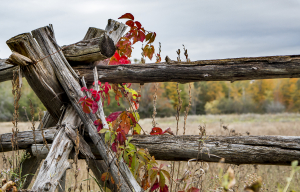
By-Laws
By-Laws

Commonly Requested By-laws
Policies
A Policy is defined as corporate direction that is formally adopted by Council resolution. Enacting policies provides a framework for decision making ensuring consistency throughout the municipality.
The supporting legislation for such policy development is the Municipal Act. It specifically provides Council the authority to develop and evaluate the policies and programs of a municipality.
Policy Areas
| Complaint Policy |
Public Works
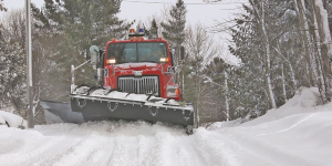
The Lanark Highlands Public Works Department maintains the roads, sidewalks, bridges, culverts, ditches, and storm sewers within the municipal right-of-way. They also maintain streetlights and are responsible for snowplowing and snow removal. In the village of Lanark, our operators clear snow on a priority basis, with high-volume routes receiving the highest priority. Outside of the village, our operators use tandem trucks with sanders and front/wing plows, maintaining distinct routes, clearing snow on a priority basis with arterial roads and school bus routes receiving the highest priority. If you are a homeowner or contractor looking to work within the municipal right of way, please contact Kathryn Maton, Manager of Public Works.
For more information on municipal roads, please click here.
Public works also oversees the contract for the operation of the six transfer stations and one landfill site located in the Township. Additionally, Public Works maintains the curbside contract for the village of Lanark which is paid for by users through a separate tax levy. The Township runs a seasonal hazardous waste depot at the Middleville transfer station.
For more information on household hazardous waste and waste management, please click here.
For waste transfer station operational hours, please click here.
ROAD EMERGENCY PHONE NUMBER
613-264-7329
Please call this number ONLY in case of a road related emergency or
potential danger that requires immediate attention.
Building
Moving to Lanark Highlands

The Township of Lanark Highlands has a lot to offer its residents. We have programs and services for people of all ages and lifestyles. From recreation and sports to community services, we have it covered.
Check out our calendar of events or the details related to building or renovating, be sure to contact us for assistance.
If you are interested in something that you don't see on our website, please contact us. We'll be happy to help.
Accessibility

Accessibility Plan
Multi-Year Accessibility Plan 2024-2028
The Ontario Government passed the Accessibility for Ontarians with Disabilities Act in 2005.
Standards were set in the act for business and organizations in the province. By following these standards we are able to improve opportunities for people with disabilities and provide for their involvement in the identification, removal and prevention of barriers to their full participation in the life of this Province.
The Accessibility Standard for Customer Service was the first standard to become law.
The next four standards - Information and Communications, Employment, Transportation and the Built Environment (buildings and outdoor spaces) - have been combined under one regulation, the Integrated Accessibility Standards Regulation. This regulation is now law and the requirements currently in the regulation are being phased in between 2011 and 2021.
Ontario will be accessible by 2025.
- 2016-2019 Accessibility Plan
- 2010 Accessibility Plan
- 2015 Accessibility Report
- Planning Accessible Events
Accessibility Standards
The Township of Lanark Highlands is pleased to offer alternative methods of communication upon request in accordance with our compliance with Accessibility for Ontarians with Disabilities Act, 2005 ONTARIO REGULATION 429/07 ACCESSIBILITY STANDARDS FOR CUSTOMER SERVICE
- Customer Service
- Information & Communication
- Employment
- Built Environment
- Transportation
Customer Service
The Accessibility Standards for Customer Service (Ontario Regulation 429/07) came into force on January 1, 2008. The Township of Lanark Highlands, as a designated public service organization, was required to be in compliance with the standard by January 1, 2010.
- Accessibility Customer Service Standards - Policy
- Accessibility Customer Service Standards - Procedures
- Accessible Customer Service Feedback Process
- Form - Accessible Customer Service Feedback
Further Information
Ministry of Community and Social Services – www.mcss.gov.on.ca
About Lanark Highlands
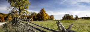
As the name suggests, Lanark Highlands offers picturesque vistas of rolling hills and Canadian Shield topography, a geology that creates the perfect terroir for maple syrup production. Among vast forest lands, the hamlets of Hopetown, Middleville, Poland, Lavant, Flower Station, Elphin, Watson’s Corners, McDonald’s Corners and the ghost town of Herron’s Mills pepper the area around the main Village of Lanark. Abundant water bodies and beaches make for prime cottage country. Feel the freedom.
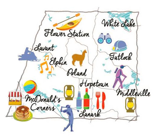
Make a Memory
- Take in the largest collection of maple artifacts in the world at Wheelers Pancake House, Sugar Camp and Maple Museum
- Get to know the animals at Serendipity Alpaca Farm
- Play a round of golf over rolling hills at Timber Run Golf Course
- Hike to the summit of Blueberry Mountain at cliffLAND
- Bring a friend for a walk with your dog on the Baird Trail
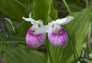
1024 Herron Mills Road, Lanark Highlands, ON - Stroll along the boardwalk at Purdon’s Conservation Area to see North America’s largest colony of Lady’s Slipper Orchids
- Research your ancestry at the Middleville Museum and Lanark & District Museum
- Swim at one of the natural beaches (Dalhousie Lake,Lanark Beach,Robertson Lake Beach)
- Meet the locals at the Middleville Fair or McDonald’s Corners Fair, where home cooking abounds
- Learn to weave or take a pottery class at MERA Schoolhouse
- See the private collection at Lanark Highlands’ Basketry Museum
- Find the best produce at the farmers’ market in McDonald’s Corners
- Try your hand at yoga and stand up paddle boarding at ARUMA
- Plan your perfect getaway with Clyde Hall B&B
The total population is a quaint 5,338 people. The village of Lanark is the main settlement.
Lanark Highlands is home to several dozen lakes and rivers, such as Clayton, Taylor, White, Dalhousie, Patterson, Flower Round and Clyde. The Mississippi River crosses the municipality from west to east and the Clyde River meanders its way from north to south to meet up with the Mississippi River south of Lanark Village. As its name suggests, Lanark Highlands also offers picturesque vistas of rolling hills and Canadian Shield topography, combining with the abundant water bodies to form prime cottage country.
![]()
75 George Street,
PO BOX 340
Lanark, Ontario
K0G 1K0
613-259-2398
1-800-239-4695
Hours of Operation:
Monday to Friday - 9:00 a.m. to 4:00 p.m.